This Trail is a County of Santa Barbara Designated Landmark
Chumash presence along the trails leading over San Marcos Pass is evidenced most spectacularly by the amazing cave paintings off today’s Painted Cave Road. Under Mexico, the missions were given huge tracts of land to hold in trust for the native population. By 1804, Santa Barbara Mission owned a cattle ranch along the Santa Ynez River with an adobe residence and an asistencia for the neophyte Chumash. Mission records reveal that the Chumash had built a road over the pass so that pine timber could be brought down to Mission Santa Barbara for the construction of neophyte housing. In 1838, under Mexico, these lands were sold as a land grant to Nicolas and Richard Den as Rancho San Marcos.
On their march south to conquer California during the Mexican-American War (1846-1848), John C. Fremont and the California Battalion arrived at Benjamin Foxen’s Rancho Tinaquaic on December 20, 1846. In a disputed story, he chose to reach Santa Barbara via San Marcos Pass rather than through Gaviota because Foxen had warned him of an ambush awaiting him there.
Regardless of the reason, the battalion camped at Rancho San Marcos on December 22. Here, they rested for a day. On the 24th, they woke to a fierce rainstorm as they began an excruciatingly difficult ascent of the mountain. They reached San Marcos Pass at its lowest point on today’s Camino Cielo about a mile from the present highway, where the weary men and exhausted horses spent the night in pouring rain.
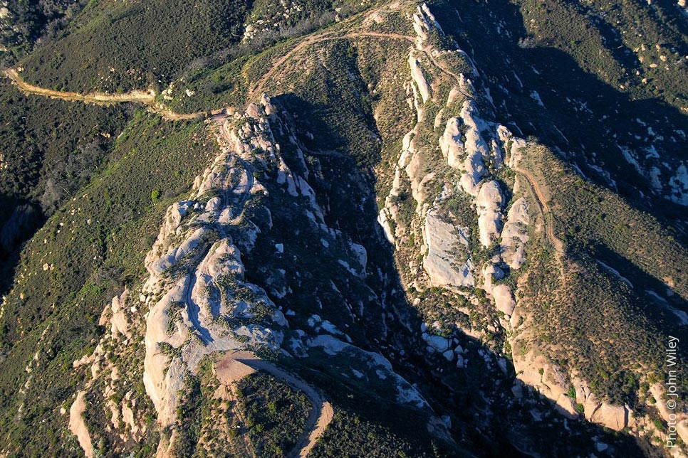
On Christmas Day, the descent over the rocky escarpment of the lands below today’s West Camino Cielo proved even worse. Horses, baggage, and armaments plunged into ravines due to the soggy soil and dangerous footing. By the time they reached the foothills, somewhere between today’s Rancho del Ciervo tract and Tucker’s Grove County Park, over 100 horses had been lost along with much of their accoutrement.
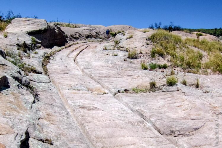
In 1861, stage service came to Santa Barbara via San Marcos Pass on a road built by Chinese labor. From Santa Barbara, the stage ascended the mountain from today’s Kellogg Road and crossed the famous “Slippery Rock,” which had been grooved to keep the metal-rimmed wheels from slipping. The road eventually led to the Kinevan Stage Station and from there down past Cold Spring Tavern, which became a relay station for the stage line. In 1892, the owner of the lands over which the stage road passed revoked the right of passage and a new route was created on what is today Old San Marcos Pass. On the other side of the mountain, today’s Old Stagecoach Road leads to Paradise Road and then the Santa Ynez Valley.
Fremont Campground on Paradise Road is named for John C. Fremont. Today’s extant Fremont trail leads from the campground to Camino Cielo. The trail to Slippery Rock was once accessed from the Rancho del Ciervo tract reservoir. (Hattie Beresford)
(Sources: Mission Santa Barbara, 1782-1965, Maynard Geiger, O.F.M., 1965; Chumash Painted Cave State Historic Park website; “Tracing Fremont’s Route with the California Battalion,” by Guy J and Helen S. Giffen; California’s Wonderful Corner by Walker A. Tompkins.)
Note: The Slippery Rock Trail is on private property and not open to the public.