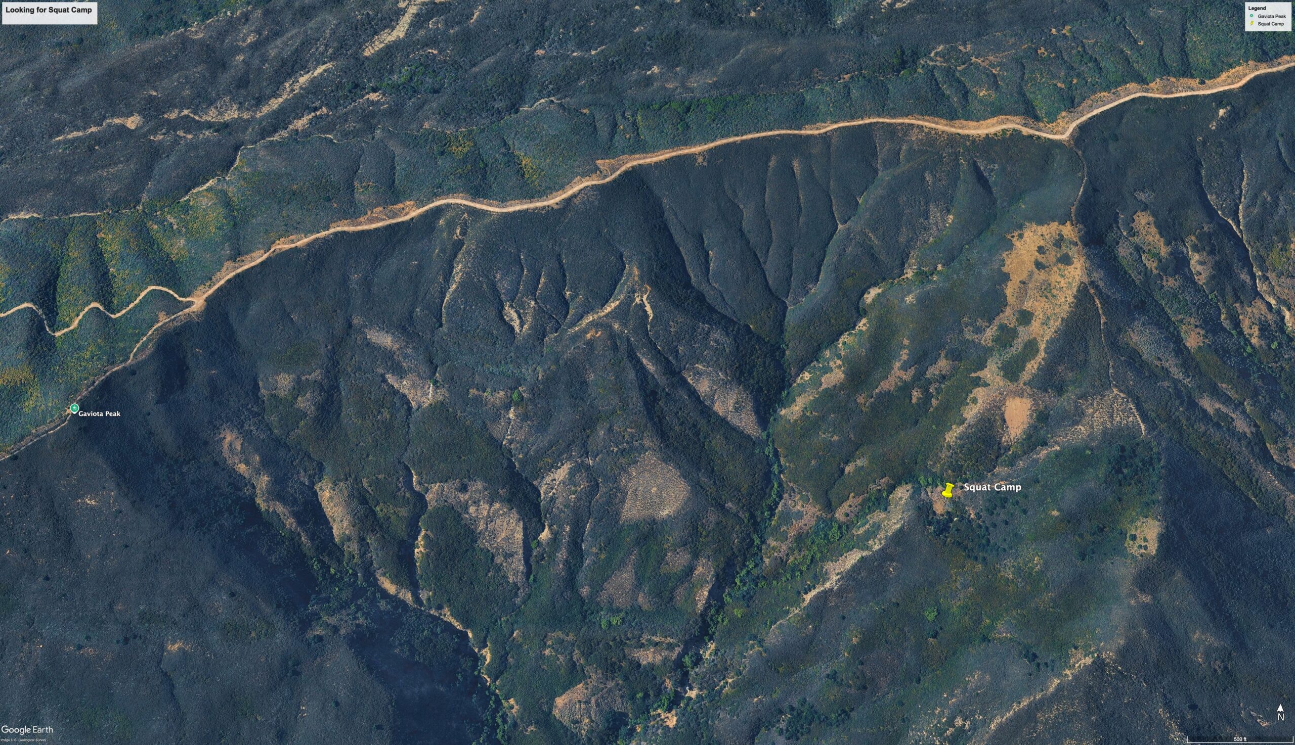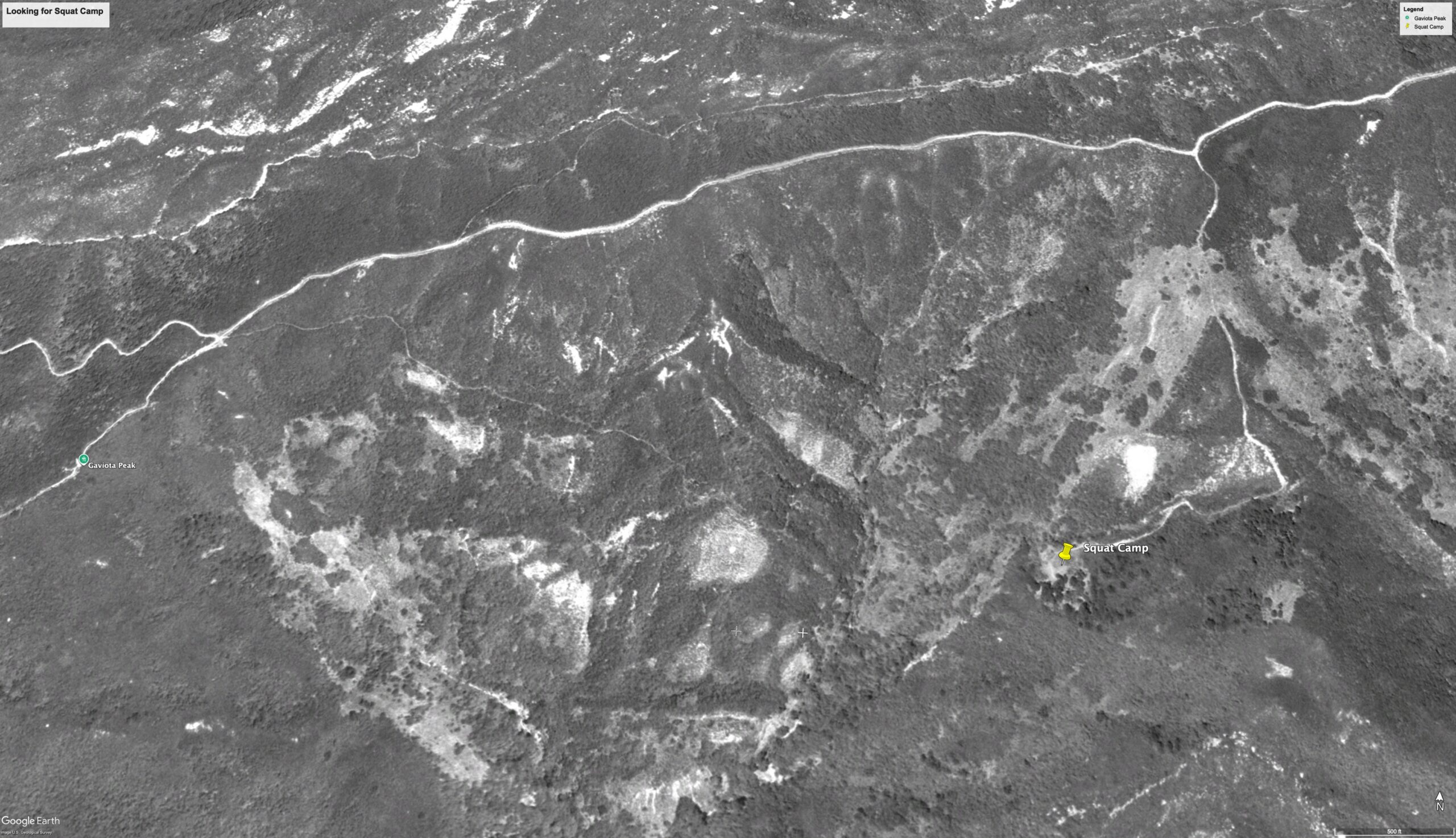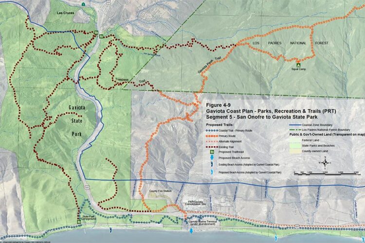
Squat Camp (often called Squat Adobe) is a historic backcountry site in the Los Padres National Forest. Located within the Santa Barbara Ranger District on the Gaviota Coast, its ruins are situated near the old Refugio Road trace and Camino Cielo. This is a use trail and not maintained by the U.S. Forest Service. It may be too overgrown to access the historic site.
The Hike Details
- Distance: ~8.5 miles round-trip
- Starting Point: Gaviota State Park just off Highway 101.
- Elevation Gain: Over 2,000 feet
- Difficulty: Strenuous
Route Overview
Start your hike at the Gaviota State Park trailhead for Gaviota Peak and the Hot Springs, just off Highway 101. Follow the Gaviota Peak Fire Road. After about three miles, you’ll reach the top of the mountains. Here, a side trail on the right climbs steeply to Gaviota Peak. If you skip the turnoff, keep heading east on West Camino Cielo, which runs along the mountain ridge. There used to be an old road across the front of the mountains to the site, but it is now badly overgrown.
It’s easy to miss the turnoff to the Squat Camp site. Look for a trail on the right that heads down the front of the mountains, following a ridge line that runs mostly perpendicular to the road. The half-mile trail to the site follows an old road cut that once led to a historic adobe. Now, the road is so overgrown that it’s basically a single-track trail. The path goes down steeply, then turns west and leads to the site. At the site, look around, and you may find a spring box.
Essential Tips
Permits & Fees: There is a day-use parking fee (typically $2) at the Gaviota State Park trailhead.
Camping Rules: The site of the adobe itself is intended as a historical day-hike destination rather than an official backcountry campground. For overnight trips in the adjacent Los Padres National Forest, dispersed camping requires an Adventure Pass and adherence to all current fire and wilderness regulations. Fires are not allowed.
Conditions: Because of heavy coastal chaparral and exposure, there is little shade and a high risk of encountering poison oak on the use trails. Pack plenty of water and sun protection.
Learn More →
James Wapotich Article: https://