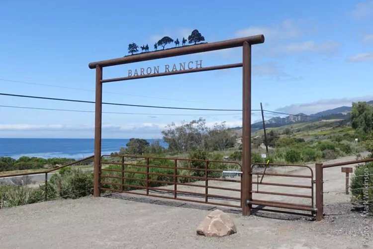
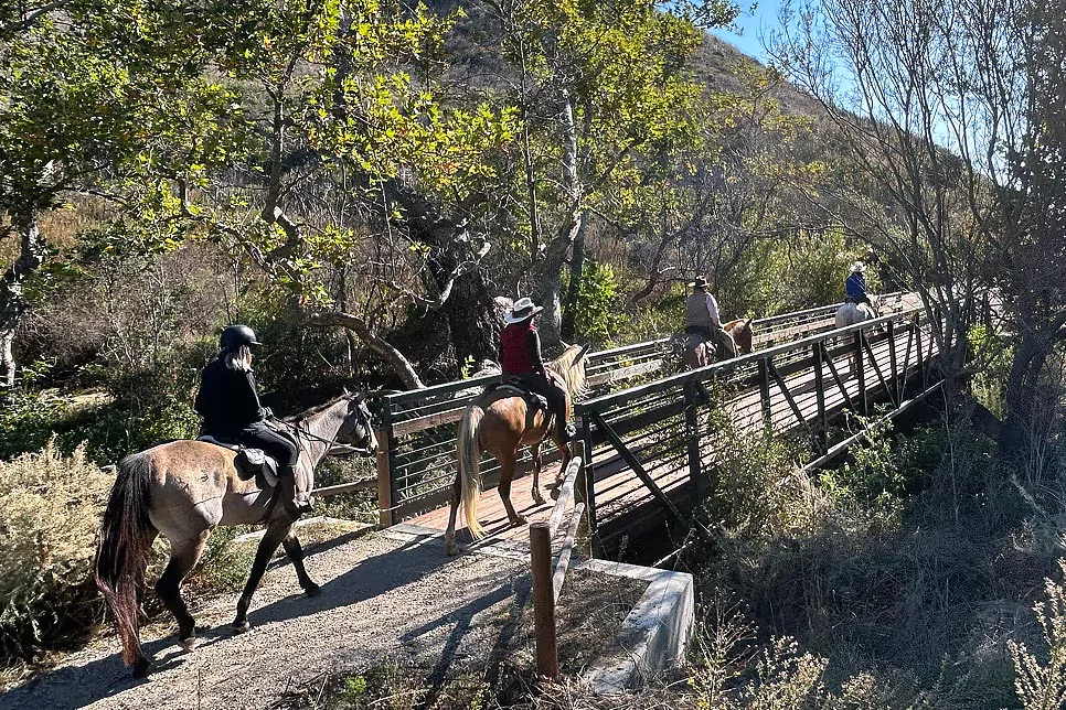
Baron Ranch offers a secluded and scenic hiking experience in the Santa Ynez Mountains, featuring diverse landscapes, habitat restoration areas, and sweeping ocean views. Located west of Refugio State Beach, the ranch is primarily used for conservation and research, with designated trails open to the public for hiking, mountain biking, and equestrian use. The main trail follows Arroyo Quemado Creek before branching into two routes: The Loop Trail for a shorter hike and the Arroyo Quemado Trail, which climbs to Camino Cielo in the Los Padres National Forest. The trail is open seven days a week to all trail users. The designated trail is the only public access, and all other areas are off-limits for conservation purposes. The trails at Baron Ranch were planned, funded, and built by the Santa Barbara County Trails Council and maintained through agreements with the County of Santa Barbara and the U.S. Forest Service. Due to the sensitive habitat and the presence of endangered species, dogs are not allowed on Baron Ranch.
Map: Baron Ranch Trails
Project History
The Baron Ranch Trails are the result of a long-term vision to expand public access along the Gaviota Coast while protecting sensitive habitats. For decades, Los Padres National Forest land west of Highway 154 had no established access from the coast. Through collaboration between the Santa Barbara County Trails Council, County of Santa Barbara, and the U.S. Forest Service, new routes were planned and constructed to change that.
The creation of the Loop Trail and the extension of the Arroyo Quemado Trail to Camino Cielo established one of only two front-country access points into Los Padres National Forest across a 26-mile stretch of coastline. These connections now link County land with West Camino Cielo and Gaviota State Park, forming a continuous 13.5-mile trail system that spans County, State, and Federal lands.This effort represents not only improved recreational opportunities but also years of coordinated conservation planning, habitat restoration, and ongoing maintenance to ensure that Baron Ranch remains both accessible and ecologically protected.
Article by Tom Modugno: Baron Ranch History
The upper reaches of the Baron Ranch Trails are maintained by professional trail crews, ensuring safe access and a high-quality experience for all users. This work is made possible thanks to generous donations from community members like you. Trail maintenance is an ongoing expense that averages $2,000 per mile, year after year. Your contribution directly supports the care of these trails and helps the Santa Barbara County Trails Council continue this vital work.
Please consider making a donation to sustain the Baron Ranch Trails and keep them open for generations to come.
Donate Today ›
Arroyo Quemado Trail
Distance: 12 miles out and back
Elevation: 2,800 feet
Difficulty: Hard
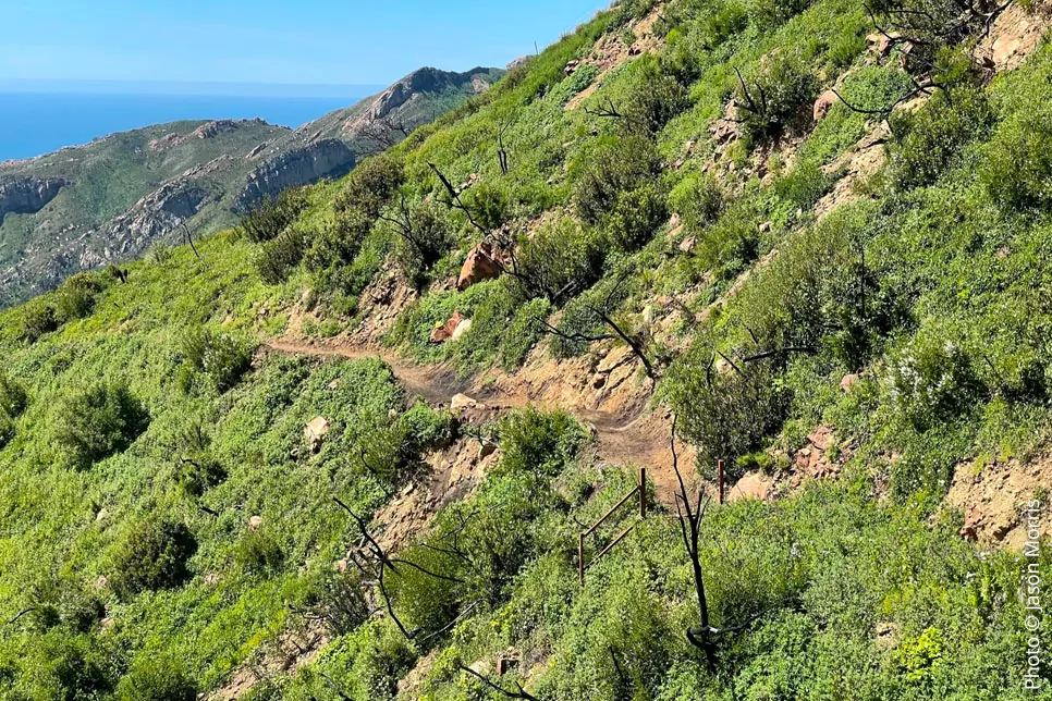
This trail is the main route through Baron Ranch, leading from Calle Real to Camino Cielo. The first mile is relatively flat, following the canyon floor and paralleling Arroyo Quemado Creek. As the trail continues, it transitions into a lush riparian zone before gaining elevation into more rugged backcountry terrain. At about three and a half miles, hikers reach a fork where the Loop Trail branches right while the Arroyo Quemado Trail continues left. From here, the trail follows a newly constructed single-track path for three and a half miles to the top of the Santa Ynez Mountains, offering panoramic views of the Pacific Ocean and Channel Islands.
Trail Link: Arroyo Quemado Trail on AllTrails
The Loop Trail
Distance: 7.75 miles out and back
Elevation: 1,500 feet
Difficulty: Moderate
For a shorter option, the Loop Trail provides an elevated viewpoint without the full ascent to Camino Cielo. The route follows Arroyo Quemado Trail for just over two miles before splitting into a loop that winds through the foothills.
The upper portion of the Loop Trail offers stunning vistas down the canyon, with clear-day views stretching across the Pacific Ocean and Channel Islands. After reaching the top, the single-track section connects back to a ranch road, leading hikers back to the main trail.
Trail Link: Baron Ranch Loop Trail on AllTrails
 Directions:
From the South: Take Highway 101 northbound, 2.4 miles past the Refugio Road exit, and turn right at the road crossing onto Arroyo Quemada Lane, just past a yellow sign indicating “cross-traffic ahead.” There is no northbound deceleration lane, so the turn-off must be anticipated. Immediately turn left onto Calle Real and proceed approximately three-quarters of a mile until the road reaches a street sign that says “End.” Use the circle to turn around and park along Calle Real.
From the North: Take Highway 101 southbound to the Refugio State Beach exit. Exit the highway, go under the freeway, and take the northbound Highway 101 onramp. Travel 2.4 miles north and turn right at the road crossing onto Arroyo Quemada Lane, just past a yellow sign indicating “cross-traffic ahead.” There is no northbound deceleration lane, so the turn-off must be anticipated. Immediately turn left onto Calle Real and proceed approximately three-quarters of a mile until the road reaches a street sign that says “End.” Use the circle to turn around and park along Calle Real.
Hiking with Dogs on the Gaviota Coast
With all the open spaces and trails in the Gaviota area, one would think that there are places that are dog-friendly. This is not the case. Dogs are not allowed on trails at the three California State Parks, Arroyo Hondo Preserve, or Baron Ranch. Dog owners will want to visit https://bit.ly/trails4dogs to find a list of dog-friendly places to hike.