Distance: 2.6 miles out and back
Difficulty: Easy, with a mostly flat surface and some uneven sections
Elevation Gain: Minimal (< 50 feet)
Map: https://healthypeoplehealthytrails.org/maps/tomol-to-tar-pits-park-trail.pdf
Trail Highlights
This scenic coastal trail offers a peaceful stroll from downtown Carpinteria through Carpinteria State Beach and onward to Tar Pits Park. It ends near the Carpinteria Seal Rookery, one of the few remaining mainland haul-out sites for harbor seals along the Southern California coast.
With interpretive signage, ocean breezes, and panoramic views of the Channel Islands and Santa Ynez Mountains, this path is a favorite for walkers, joggers, and nature lovers. Along the route, visitors can observe tar seeps, native coastal vegetation, and—during the winter and spring—resting seals on the beach below. The trail blends urban access with natural beauty, making it an ideal option for families, casual walkers, and anyone seeking a short outdoor adventure with interpretive and wildlife-viewing opportunities.
Trail Description
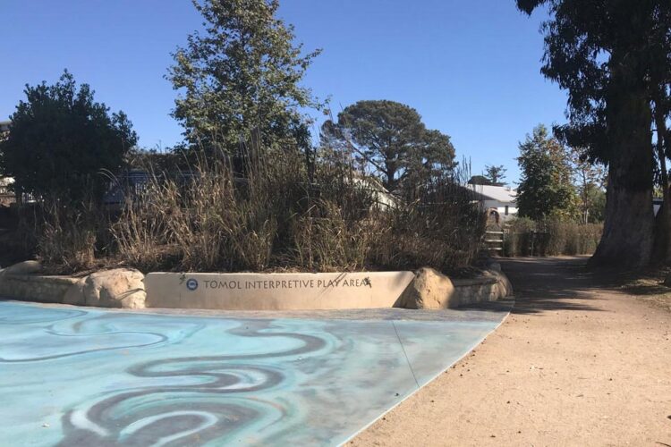
The route begins at the Tomol Interpretive Play Area on Linden Avenue, just south of Carpinteria Avenue. From the trailhead, the path runs along the northern edge of Carpinteria State Beach, passing picnic areas, interpretive displays, and several access points to the sandy shoreline.
The central portion of the trail is a paved walkway, while the outer segments transition to dirt and natural surfaces. As you continue west beyond the park, the trail leads onto a blufftop area featuring visible tar seeps, a remnant of the area's geologic history. The final portion curves along the north side of the Tar Pits Park parking lot, ending near the Seal Rookery Overlook. For the best chance of observing seals, visit between January and May, when pupping season is in full swing.
Note: Dogs are not allowed on this trail due to the proximity of sensitive marine wildlife.
Directions
Trailhead: 390 Linden Avenue, Carpinteria, CA 93013
Coordinates: 34.422078, -119.657850
From Santa Barbara, take Highway 101 south to Exit 86B for Linden Avenue. Turn right (south) onto Linden Avenue and drive 0.5 miles. The trailhead is on the left just past the railroad tracks, adjacent to the Tomol Interpretive Play Area.
From Ventura, take Highway 101 north to Exit 86 for Casitas Pass Road. Turn left (south) onto Casitas Pass Road, then right on Carpinteria Avenue. After one-third of a mile, turn left on Linden Avenue. Drive 0.5 miles to reach the trailhead at the end of the block.