Proposed Trail and Beach Access Project
In 2018, the Trails Council initiated a proposal to help plan the Jalama Coastal Trail and Beach Access Project on property acquired by the County adjacent to Jalama County Park. We secured a $20K grant from the Coastal Resource Enhancement Fund to partially fund the development of planning documents needed to secure permits for the construction of a trail across the bluff and down to the beach. This includes IS/Mitigated Negative Declaration and Biological Studies required for a Coastal Development Application. These documents are needed to prepare additional permits required by the Army Corps of Engineers, CA Fish & Wildlife, and the CA Water Quality Board before construction.
The preliminary plans developed by the Trails Council played a key role in securing the grant funds and setting the stage for the development of the Jalama Coastal Trail and Beach Access Project.
Goal
Complete substantial coastal access improvements on newly acquired land at Jalama Beach County Park, including the following:
- Construction of a new coastal access trail and short stairway down a steep eroded canyon known as “the crack” to provide coastal and beach access to the popular surf break, Tarantula’s.
- Completion of a ¾ mile long segment of the California Coastal Trail along newly acquired bluff-top lands.
- Construction of up to 50 new coastal access parking spaces proximate to the new coastal access trail and short stairway.
These improvements, the existing setting, and the anticipated regulatory process are described below.
Overview
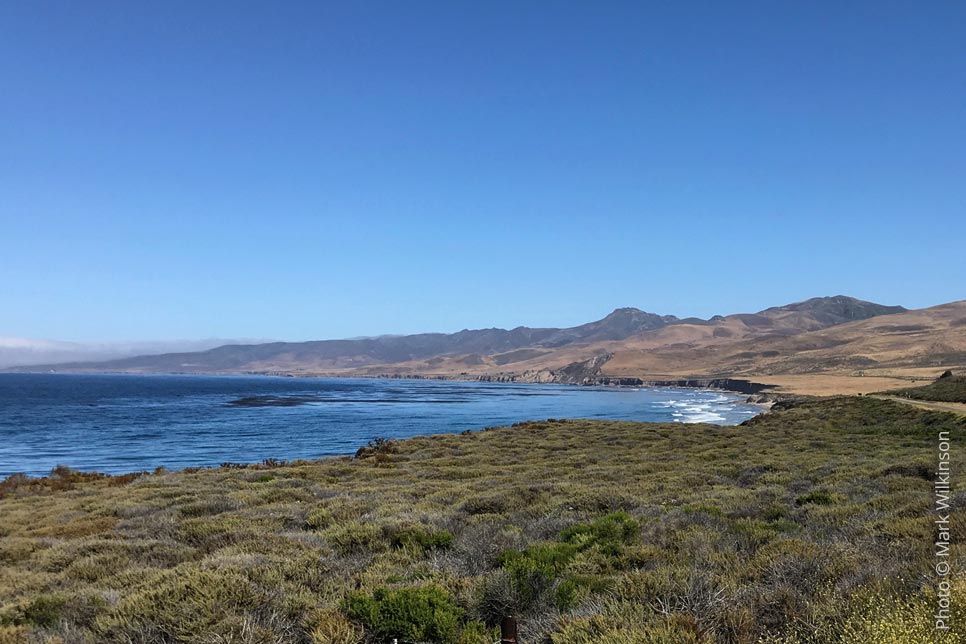
Jalama Beach County Park (Park) is an isolated public park located amidst rural ranch lands more than 60 miles northwest of Santa Barbara and 25 miles southwest of Lompoc. The Park is the only public coastal access point along more than 60 miles of Northern Santa Barbara County (North County) shoreline. It is one of only four coastal access points in the entire North County, an area with almost 200,000 residents. The Park currently provides approximately 110 day-use coastal access parking spaces, and is the only public campground in North County.
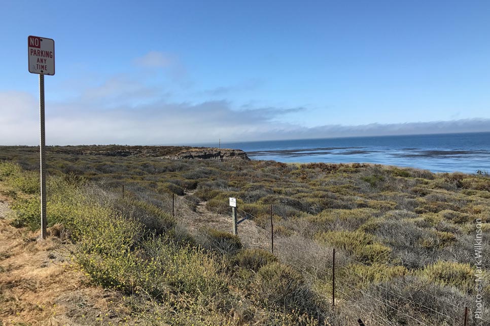
The Park’s 110-day-use coastal access parking spaces are typically filled early in the day during peak periods, which include the summer season, most weekends, and during times of major surf swells. During these times, long lines of cars wait for extended periods for coastal access parking to become available. In addition, surfers have historically trespassed across formerly private lands down the crack to access Tarantulas during periods of high surf. However, the County has recently acquired 36 acres of land south and east of the existing Park, including more than 3/4s of a mile of ocean front bluff top lands along both sides of Jalama Beach Road, which includes the existing informal historic beach access point at the crack.
Setting: The existing Park is primarily located within low-lying level areas along the south bank of Jalama Creek and the lower slopes of adjacent hillsides. Access to the Park is via Jalama Road from State Route 1, which turns into Jalama Beach Road at the “at-grade” crossing of the Union Pacific Railroad (UPRR) line located approximately 3,000 feet south of the Park’s entrance gate. Jalama Beach Road parallels the shoreline for this 3,000-foot reach across formerly private lands, and is setback 50 feet to almost 200 feet from the coastal bluff. The bluff top between the road and bluff face is generally level or gently sloping, is vegetated with coastal bluff scrub, and is punctuated by three small shallow eroded drainages that extend from the bluff face almost to the western edge of the road.
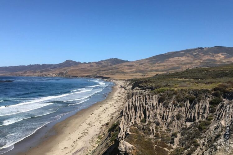
The existing informal coastal access trail at the crack and road shoulder parking is located 200 feet southwest of the Jalama Beach Road-UPRR at-grade crossing. The bluff top north of the crack is approximately 100 feet in elevation above the beach and up to 200 feet wide between Jalama Beach Road and the bluff face. The crack is a small coastal drainage of 20 to 60 feet deep, which extends for approximately 470 feet from the UPRR to the beach. The crack is highly eroded with steep slopes and a canyon bottom devoid of vegetation in most locations; however, the eastern 120 of the crack adjacent to UPRR supports dense stands of poison oak with some willows, and water has been observed in this area, even during the dry season. Existing informal coastal access is via a relatively wide dirt road shoulder down across the gently sloping coastal bluff and then the very steep northern slope of the crack to the canyon bottom. Users then traverse the canyon bottom to a large unconsolidated shale slump at the base of the canyon and down the remaining 40 feet to the beach.
[add photo of crack]
Proposed Coastal Access Improvements
The County considered several options for improving coastal access through the newly dedicated 36 acres of land south of the developed area of the Park. Because of the steep 100-foot high coastal bluff, patterns of existing use and high demand to access the renowned Tarantulas surf break, these options all focused on the crack as the only feasible route down the bluff face proximate to the surf break. The steep and highly eroded nature of this canyon presents challenges for constructing and maintaining formal public access, so three options were considered, ranging from an informal trail with a flexible stairway to a major engineered stairway down the bluff face. However, because of the cost of a major engineered stairway and its incompatibility with this rural area, this option is not preferred. Similarly, an informal trail with a flexible rope-anchored stairway is not preferred for formal public access across County-owned land, as it is challenging to meet standard trail design criteria for public safety and ease of long-term maintenance.
LEARN MORE →
Concept drawing prepared by Trails Council:
Drone Video of the project area: